Is There a Hike from Tung Chung to Tai O?
Yes, walking routes cross Lantau between Tung Chung and Tai O, but no official distance or duration is published. Here is what the verified bus fares, climate data and closing times mean for your plan.
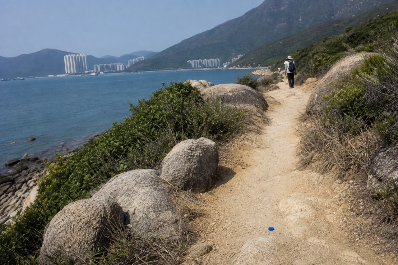
Is There a Hike from Tung Chung to Tai O?
Yes, walking routes across Lantau Island do connect Tung Chung to Tai O, but no official source publishes a distance, a duration or a difficulty grading for the direct walk, and the two places sit on opposite coasts of an island whose terrain includes Hong Kong's second-highest peak. For most visitors the honest answer is the bus: New Lantao Bus 11 runs from Tung Chung Station to Tai O for HK$14.00 on a weekday (checked September 2026).
Start with the geography, because it explains everything else. Tung Chung is the transport hub on Lantau's north shore: the MTR terminus, the airport buses and the cable car terminal all sit within a short walk of each other. Tai O is the stilt-house fishing village on the island's far western coast. Between the two lies the Lantau hill country, including Lantau Peak at 934 m, Hong Kong's second-highest summit, and Nei Lak Shan at 751 m, the sixth-tallest, inside a country park established in 1978 that covers some 22 square kilometres. Any route on foot between the two settlements has to cross or skirt that high ground.
Now the honest part. The verified fact record behind this site carries no trail distance, no walking time and no elevation profile for a direct Tung Chung to Tai O walk, and no official body, the cable car operator, the bus company, the Tourism Commission or the country park authority, publishes one either. Plenty of third-party blog posts print confident numbers. This article will not join them. Instead it widens the frame to what can actually be verified: what walking on this island demands in Hong Kong's climate, what the buses cost, what Tai O itself offers, and how any of it fits alongside the cable car.
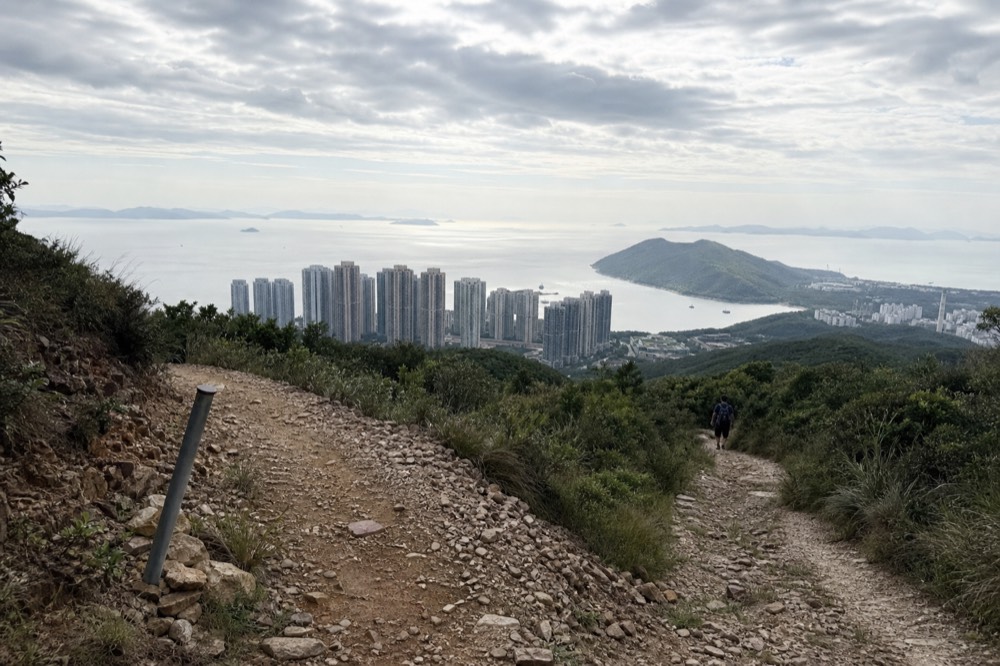
What can be said about the trail network itself is real but thin. The Lantau Trail exists and crosses the island's hill country; the Tourism Commission's own material confirms sections of it near the Wisdom Path, on the plateau below Lantau Peak. Third-party hiking reports put the ascent of Lantau Peak in the 1.5 to 2.5 hour range depending on the starting point, and those figures should be treated as approximate reports, not published statistics. Nothing in the official record turns that fragmented picture into a graded, timed route from Tung Chung to the coast.
That is the frame for everything below: the buses, the climate, the village, the pairing with the cable car, and a plain statement of who should stay off the trail entirely.
If you do decide to walk part or all of the way, the rest of this article is built around the numbers that can actually be checked, and around the gaps that cannot. Where a figure does not exist in any official source, the article says so rather than filling the silence with a guess.
How do you get from Tung Chung to Tai O without walking?
New Lantao Bus route 11 runs direct from Tung Chung Station to Tai O, at HK$14.00 for an adult on a normal day and HK$23.30 on a Sunday or public holiday (checked September 2026). Route 21 links Ngong Ping to Tai O in about 20 minutes for HK$7.90, or HK$19.20 at weekend rates.
The bus network is the backbone of any Tai O plan, and its fares are the one set of hard numbers in this whole debate. The table below shows the three routes that matter, with the weekday and Sunday or public-holiday adult fares from the government's open transport data (checked September 2026).
| Route | Runs between | Weekday fare | Sunday / public holiday fare | Verified notes |
|---|---|---|---|---|
| NLB 11 | Tung Chung Station and Tai O | HK$14.00 | HK$23.30 | The direct option; journey time not published |
| NLB 21 | Ngong Ping and Tai O | HK$7.90 (checked September 2026) | HK$19.20 | About 20 minutes per the operator's own page |
| NLB 23 | Tung Chung (Tat Tung Road) and Ngong Ping | HK$20.40 (checked September 2026) | HK$37.00 | The winding Tung Chung Road alternative to the cable car |
Two things in that table deserve a second look. The first is the Sunday penalty. Route 23's holiday fare is 81 percent higher than its weekday fare, a verified jump, and routes 11 and 21 rise sharply too. The fallback transport costs most on exactly the days when visitors have the free time to use it. The second is what is missing: the open-data feed carries stops and fares only. The timetable endpoint returns nothing, so there is no verified frequency, no journey time for route 11 and no first or last departure to plan around. The single operator-confirmed timing on these routes is that route 21 from Ngong Ping to Tai O takes about 20 minutes.
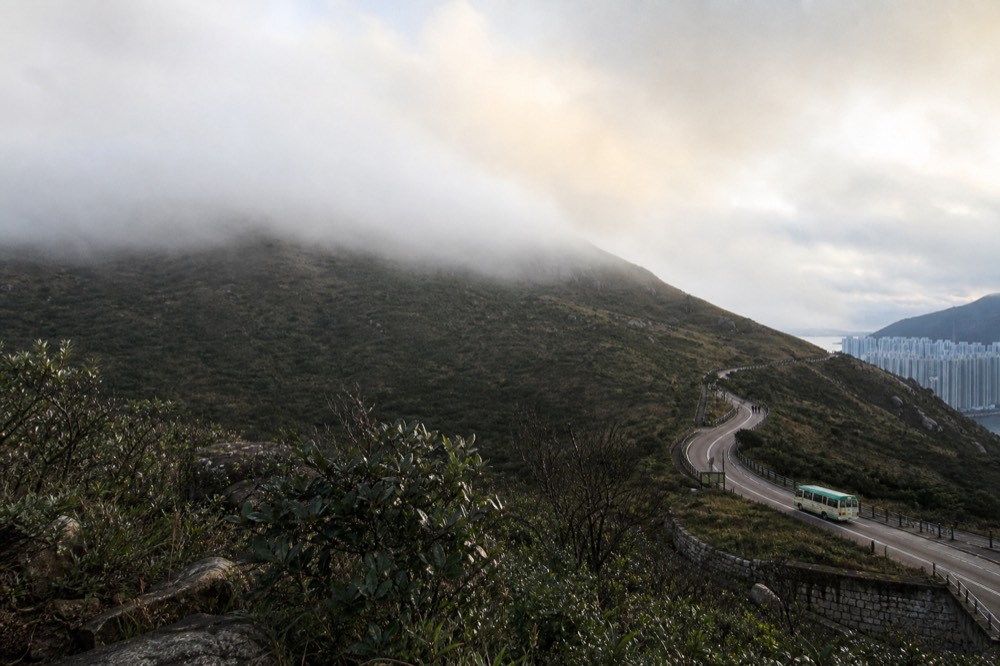
Route 23 deserves its own warning paragraph. It climbs Tung Chung Road over the mountain, a winding single-carriageway route on which some passengers reliably get motion sick, and it is the standard replacement service whenever the cable car suspends for maintenance or weather. If you ride it, sit near the front and look at the road ahead.
Getting to the start of all this is cheap and fast. The MTR Tung Chung Line runs from Hong Kong Station to Tung Chung in about 30 minutes, at HK$24.30 with an Octopus card or HK$28.00 for a single-journey ticket (checked September 2026), and the cable car terminal is a five-minute, roughly 300-metre walk from Tung Chung Exit B. The bus terminus for routes 11 and 23 sits beside the same station. One metro ride, one bus, and you are in Tai O for less than the price of a coffee in Central.
What does walking on Lantau actually demand?
Hong Kong's official climate record shows the two hazards that matter to anyone on foot on Lantau: fog concentrates almost entirely in February to April, with 3.40 of the territory's 3.70 annual fog days falling in those three months, while tropical cyclone warning signals peak in August at an average of 4.17 days. Heat, humidity and the 18:00 weekday closing time at the cable car (checked September 2026) do the rest.
The numbers come from the Hong Kong Observatory's 1991-2020 climatological normals, and they split the year into three very different walking seasons. Fog is a late-winter and spring problem, not a summer one: February and March combine the year's lowest sunshine totals, 101.7 and 100.0 hours, with its highest relative humidity, 79 and 82 percent, and nearly all of Hong Kong's 3.70 annual fog days. Typhoon signals are a summer and autumn problem, averaging 15.87 days a year and peaking hard in August at 4.17 and September at 3.83. October and November are the statistical sweet spot: the year's lowest humidity, 73 and 72 percent, low rainfall, high sunshine and no recorded fog days at all.
| Month | Fog days | Cyclone signal days | Rainfall (mm) | Sunshine (hours) | What it means for a walking day |
|---|---|---|---|---|---|
| February | 1.10 | 0.00 | 38.9 | 101.7 | Peak fog season, lowest sunshine |
| March | 1.47 | 0.00 | 75.3 | 100.0 | Fog plus rising rain |
| April | 0.83 | 0.20 | 153.0 | 113.2 | Fog tail ends, wet season begins |
| August | 0.00 | 4.17 | 453.2 | 182.1 | Peak cyclone risk, heaviest heat |
| October | 0.00 | 1.70 | 120.3 | 197.8 | Best visibility, drying out |
| November | 0.00 | 0.57 | 39.3 | 172.3 | Cool, clear, low rain |
One caveat the Observatory itself would insist on: those are urban figures recorded at headquarters, near sea level. Ngong Ping sits high on the Lantau plateau and runs measurably cooler, wetter and cloudier than the city below. Treat the table as the shape of the year, not as a forecast for the trailside.
Then there is the clock. The cable car runs 10:00 to 18:00 on weekdays and 09:00 to 18:30 on Saturdays, Sundays and public holidays (checked September 2026), and those hours are longer at weekends precisely because weekends are busier. A walking day on Lantau has to be built backwards from closing times, not forwards from enthusiasm. And since no first or last bus time is published for the NLB routes, a walker who finishes in Tai O late in the afternoon has no verified schedule to fall back on, only the hope that a bus comes. Carry more water than feels reasonable; no official source verifies water points along any high route, so assume there are none.
None of this makes walking on Lantau impossible. It makes it a planning exercise with real constraints: a fog season that eats visibility, a typhoon season that can shut transport island-wide, closing hours that end the day early, and an absence of published timetables that removes the safety net. Walkers who respect all four do fine. Walkers who ignore any one of them tend to write the one-star reviews.
What is Tai O and why do people go?
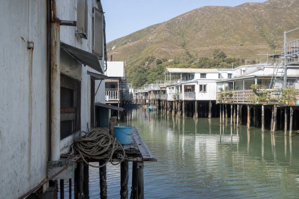
Tai O is Hong Kong's oldest fishing village, built on stilt houses over the waterways on Lantau's western coast, and it is the destination the buses serve. The 20-minute boat excursion passes the stilt houses and the former Tai O police station, now a heritage hotel, and the village's Dragon Boat Water Parade was inscribed on China's national intangible cultural heritage list in 2011.
The village is the payoff for the whole journey, and it is unlike anything else in Hong Kong. Stilt houses stand over the tidal channels, sampans tie up along the main street, and the pace drops to something the city forgot decades ago. Per the operator's own Tai O page, the boat excursion is a 20-minute ride from boats moored under the iron footbridge, passing the stilt houses, a rock formation known locally as General's Rock, and the Tai O Heritage Hotel, which occupies the village's former police station. The Dragon Boat Water Parade, in which villagers carry deity statues through the waterways at the festival, joined China's third national intangible cultural heritage list in 2011.
Tai O sits about a 15-minute drive from Ngong Ping, or the roughly 20-minute ride on route 21 from the bus terminus five minutes' walk from Ngong Ping Village. That proximity is why the village features in almost every Lantau day plan, and our Tai O fishing village guide covers the streets, the boats and the food in detail.
For visitors who would rather not sequence buses themselves, a guided day does the same loop with someone else holding the timetable. The five-hour tour pairs the cable car and the Big Buddha with a Tai O boat trip, from $67.6, rated 4.7 across 652 reviews on the live listing (checked September 2026). It is an honest alternative for anyone who reads the bus section above and decides that turn-up-and-wait is not how they want to spend a holiday morning.
How does a Tai O visit pair with a cable car day?
The cable car runs 5.7 km from Tung Chung to Ngong Ping in about 25 minutes each way, and Ngong Ping is a 15-minute drive or a roughly 20-minute bus ride on route 21 from Tai O, so the standard pairing is cable car out, bus to Tai O, bus back to Tung Chung. A round-trip Standard Cabin ticket costs $29.39 (checked September 2026), with free cancellation before redemption on the standard tiers.
The geometry is generous. One 25-minute ride lifts you onto the plateau at Ngong Ping, next to the Big Buddha and Po Lin Monastery, and from there Tai O is a single short bus hop away. The site you are reading, Hong Kong Ngong Ping Cable Car, exists around exactly that pairing, and the ride itself is the centrepiece: 5.7 km over Tung Chung Bay, the airport, the cross-sea bridge and the country park, in cabins that leave continuously. Ngong Ping 360 is a subsidiary of the MTR Corporation, which also runs the metro line that brought you to Tung Chung in the first place.
| Way to do the day | What it covers | From (USD) | Rating on the live listing |
|---|---|---|---|
| Cable car ticket only | The 25-minute ride each way; you plan the plateau and Tai O yourself | $21.15 one way (checked September 2026), $29.39 round trip | 4.7 from 61,490 reviews |
| Guided 5-hour tour | Cable car, Big Buddha and a Tai O boat excursion | $67.6 | 4.7 from 652 reviews (checked September 2026) |
| VIP priority 7-hour tour | Priority boarding, Big Buddha and Tai O in a small-group day | $100.76 | 4.5 from 362 reviews |
All figures in that table are from the operators' live listings (checked September 2026). The ticket-only route is the flexible one, and the ladder on it runs from $21.15 for a one-way Standard Cabin through $29.39 for a round trip to $31.55 for a round trip in the glass-floored Crystal Cabin, with free cancellation before redemption on the standard tiers.
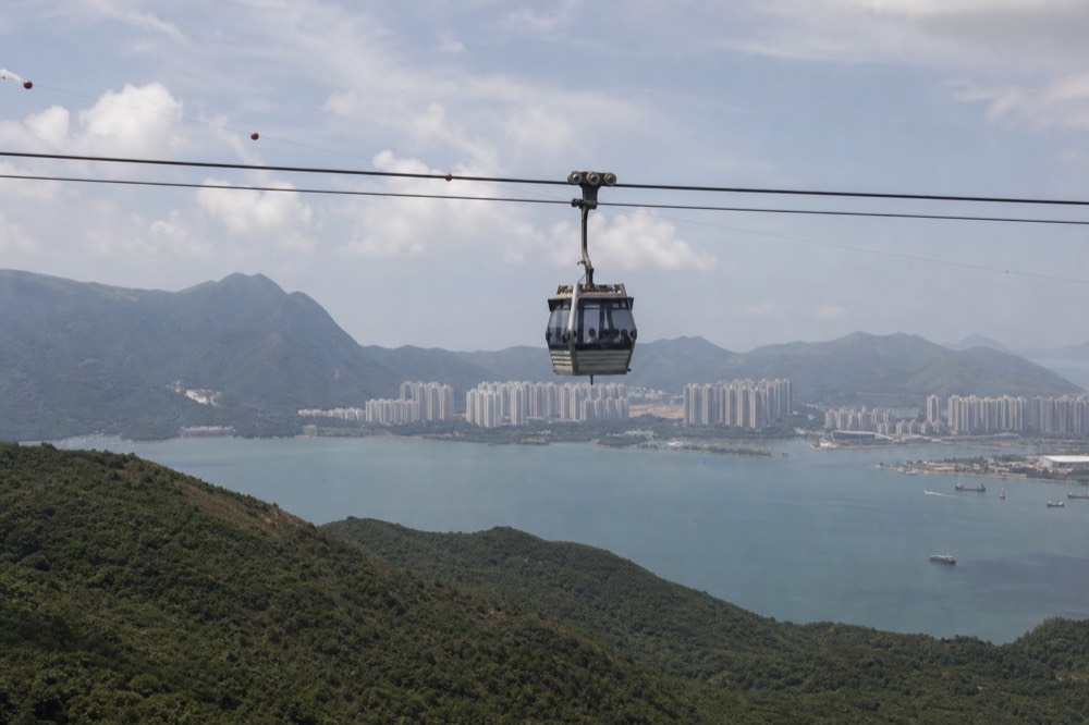
Two practical warnings belong in any cable car day plan. First, luggage: by the Tung Chung Cable Car Bylaw, anything over 48 x 34 x 23 cm or 4 kg is barred from the cabins, and left luggage at the terminal costs HK$100 per piece (checked September 2026), a rule that catches airport-stopover visitors every day. Second, the September maintenance window: the cable car is suspended 8 to 18 September 2026 while the village stays open, and route 23 is the replacement, exactly as covered in the bus section above.
One more caution that is easy to miss. Since 29 May 2026 the operator has refused boarding to anyone holding a ticket bought from street touts near Tung Chung station, some of whom wear clothing resembling staff uniforms and resell already-used tickets. The official ticket office is on the first floor of the terminal, and a ticket from the operator's live listing scans straight through the turnstile.
The ticket itself is the most-reviewed product on this whole route, 4.7 from 61,490 reviews, from $21.15 (checked September 2026), and for most visitors it is the single purchase that makes the entire day work.
Who should not attempt the walk, and what nobody publishes
Anyone who cannot climb steadily for hours in high humidity, anyone visiting between June and September, when cyclone signals average 4.17 days in August alone, and anyone who needs published trail data should all take the bus. No official source publishes a distance, duration or difficulty rating for a direct Tung Chung to Tai O walk, and the only hard numbers that exist are the bus fares, starting at HK$14.00 from Tung Chung (checked September 2026).
The heat case is the simplest. June, July and August carry 491.5, 385.8 and 453.2 mm of rain respectively, humidity sits above 80 percent, and the cyclone signal season peaks right on top of it. Sustained climbing in those conditions is a different sport from a European or North American day hike, and heat exhaustion does not care how fit you look.
The wind case is more interesting, because the numbers are real but old. A 2006 reply from Hong Kong's Legislative Council states the system was designed to suspend in sustained winds of 90 km/h or gusts of 135 km/h, with sustained defined as the 30-second average, and Observatory measurements at Ngong Ping found those conditions occurred on an average of 7 days a year, totalling 23 hours, within operating hours. Those are design-era figures, and the operator publishes no current wind threshold, so treat them as the shape of the risk, not today's policy. What they do establish is that the high ground a walker crosses is genuinely windy ground.
Route-finding has its own trap. The Wisdom Path, the 38-column Heart Sutra installation below Lantau Peak, has been closed since 5 June 2025 for refurbishment, with completion due in the last quarter of 2026 and a staged reopening announced through the Tourism Commission's own page. Many older walking guides still route a Lantau circuit through it. Anyone following a dated description of the island's trails should check that first.
| What a walker wants to know | Is it published? | Where it stands |
|---|---|---|
| Distance and time for a direct Tung Chung to Tai O walk | No | No official source carries either figure |
| NLB 11 journey time and frequency | No | Open data carries fares only |
| NLB first and last departures | No | Timetable endpoint returns nothing |
| Cable car last boarding on a normal day | No | Only the date-limited 2026 Night Ride published a figure |
| Wisdom Path status | Yes | Closed since 5 June 2025, reopening in stages through late 2026 |
| Bus fares on every route | Yes | Full weekday and Sunday fares in government open data |
The verdict, in plain terms. Casual visitors, families, anyone on a short stopover, and anyone who has read this far and felt their enthusiasm cool: take route 11 and spend the saved hours in Tai O itself. Keen walkers with map skills, a full water load and an October or November date can consider the island's trails on their own terms, ideally as part of a wider plan like our Lantau Island day trip itinerary, and anyone who wants a shorter, better-documented walk on the island should look at hiking to the Big Buddha instead, where the route and its 268 steps are properly described.
The questions below cover the gaps that matter most to anyone planning this route: whether the walk exists, how long it takes, what the buses cost, and how it fits with a cable car day. The short version is that the buses are verified and the trail is not, so the answers lean on the numbers that can actually be checked.
Common questions about hiking from Tung Chung to Tai O
Is There a Hike from Tung Chung to Tai O?
Walking routes across Lantau Island do connect the two, but no official body publishes a distance, a duration or a difficulty grading for the direct walk, and this site will not invent one. The verified alternative is New Lantao Bus 11, direct from Tung Chung Station to Tai O for HK$14.00 on a weekday (checked September 2026).
How long does it take to walk from Tung Chung to Tai O?
Nobody official says. The verified fact record carries no trail distance, duration or elevation profile for the route, and neither the operator, the bus company nor the Tourism Commission publishes one. Third-party figures exist but are not primary sources. Treat any confident number you read elsewhere with caution.
Is there a direct bus from Tung Chung to Tai O?
Yes. NLB route 11 runs direct between Tung Chung Station and Tai O, at HK$14.00 for an adult on a normal day and HK$23.30 on a Sunday or public holiday (checked September 2026). Frequencies and journey times are not published in the open data, so arrive expecting to wait.
Can you visit Tai O and ride the cable car on the same day?
Yes, and it is the standard pairing. The cable car covers Tung Chung to Ngong Ping in about 25 minutes, and route 21 then runs from the Ngong Ping bus terminus to Tai O in about 20 minutes for HK$7.90 on a weekday (checked September 2026). Build the day around the 18:00 weekday or 18:30 weekend closing time.
When is the best time of year to walk on Lantau?
October and November, on the official numbers: the year's lowest humidity, 73 and 72 percent, low rainfall, no fog days and high sunshine. Avoid February to April, when 3.40 of Hong Kong's 3.70 annual fog days fall, and be careful in summer, when cyclone signals peak at 4.17 days in August.